$250.00 – $350.00 inc GST
The AS 1289 Site Classification source soil mapping data is based on the Atlas of Australian Soils which is currently the most consistent available national source of soil type classification.
GeoReports has enhanced the ASC source data by using selected parameters in the source data (i.e textural descriptors and clay content) to provide weighting to site reactivity correlations developed by Fitzpatrick (2013) in order to generate location-specific shrink-swell behaviour catergories for all soil groups. GeoReports has undertaken benchmaring of site nationally against laboratory test samples to validate and improve correlations.
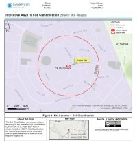
- GeoReports’ Indicative Site Classification Reports provide only a general and preliminary site screening and estimation of indicative AS2870 Site Classification for ‘Normal’ sites based on published reactive potential of natural soils occurring near the subject site (See notes in Appendix B for definition of ‘Normal’ sites).
- Indicative Site Classification Reports are not intended to replace physical site inspection, soil sampling, laboratory testing and professional assessment to assess individual site factors and provide tailored site-specific advice.
- Indicative Site Classification Reports should not be used as a basis for detailed engineering design of foundation systems without further site-specific physical sampling, laboratory testing and assessment as outlined in AS2870.


